Fabaceae › Acacia › 171 of 181
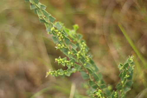
Acacia trapezoidea (DC.) G.Don
Also called Acacia decipiens var. major, Acacia decipiens var. multiflora, and 8 more.
| Family | Fabaceae |
|---|---|
| Native to | Western Australia · Kew's World Checklist, file of 2026-06-04 |
| Your plants | Add one · related species |
Fabaceae · Western Australia
Family Fabaceae
Native to Western Australia
Cited as Kew's World Checklist cites it, Acacia trapezoidea (DC.) G.Don: GBIF's backbone key for this page carries the name with another author, (DC.) Jacques.
Habitat in shortFigures ›
- Cold floor
- 9.3 °C 1 night in 100 colder NASA POWER
- Rain
- 974 mm a year, median across the range CHELSA
- Open-sky light
- 13–47 DLI lowest to highest month CHELSA
- Season
- Wet winters Nov–Mar, your months CHELSA
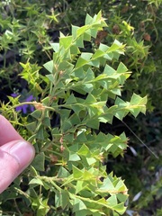


 63 photographs ›
At a glance
- Jan, shaded
- Feb, shaded
- Mar, shaded
- Apr
- May
- Jun
- Jul
- Aug
- Sep
- Oct
- Nov, shaded
- Dec, shaded
Hardiness of the habitat
| USDA zone of the habitat | 11b | the mean of the typical spot’s lowest night in each of 44 complete years, 1981–2024: 8.4 °C = 8.4 × 9 ÷ 5 + 32 = 47.12 °F, in zone 11b (45 to 50 °F). USDA’s zones are the 30-year mean of each year’s lowest temperature, in 10 °F zones with 5 °F half-zones (USDA Plant Hardiness Zone Map); this mean is of the years the series holds, not USDA’s 1991–2020. |
|---|---|---|
| RHS band of the record low | H1c | the record low falls in RHS’s H1c band (5 to 10 °C: heated glasshouse, warm temperate; RHS hardiness rating): 6.8 °C, the lowest night in 44 years. |
Both are the habitat’s, worked out from where it grows wild: neither is a tested hardiness of the plant. Lows from NASA POWER (MERRA-2) daily 1981–2024, cell -34.00_115.000, lapse-corrected +41 m at 6.5 °C/km.
Climate class
Csb Köppen–Geiger, worked out from the median year of the range’s 134 cells
| C temperate | the coldest month 13.1 °C, over 0 and under 18 °C; the warmest 19.3 °C, over 10 °C; not arid: 1010 mm a year, 10 × 32.1 mm (2 × 16.0: 80% of the rain in winter, 70% or more) or more |
|---|---|
| s dry summer | the driest summer month (summer October to March) 17 mm, under 40 mm and under a third of the wettest winter month's 182 mm |
| b warm summer | the warmest month under 22 °C, 12 months over 10 °C |
By the thresholds of Peel, Finlayson and McMahon (2007), Hydrology and Earth System Sciences 11, 1633–1644, Table 1; summer is the warmer of October to March and April to September. The class of the median year, each month’s median across the cells, not of each cell.
Walter–Lieth: arid in December to March, where the month’s rain in mm is under twice its mean temperature in °C (January 17 mm against 2 × 18.8 = 37.6). The scale of Walter and Lieth’s climate diagrams (1960–1967), 10 °C to 20 mm.
The months read: CHELSA V2.1 1981–2010 climatology, 0.05° cells (each the mean of ~36 1 km pixels).
At home, aim for (worked out from the figures above)
| Winter nights | 10–13 °C | the August mean nightly low, 10th to 90th percentile across the 134 cells of the range, median 10.9 °C (CHELSA V2.1, 1981–2010); its coldest night on record was 6.8 °C (NASA POWER, daily lows over 44 years at the typical spot) |
|---|---|---|
| Summer days | 21–26 °C | the February mean daily high, 10th to 90th percentile across the 134 cells of the range, median 22.4 °C (CHELSA V2.1, 1981–2010) |
| Grow light, 14 h a day | 589 µmol/m²/s | the year’s mean daily light, 29.7 mol/m²/day (the twelve monthly medians averaged; open sky, CHELSA V2.1, 1981–2010 solar radiation at 2.07 mol of PAR per MJ), × 1,000,000 ÷ (14 × 3,600) |
| Humidity | 58–59% | the lowest and highest of the twelve monthly median relative humidities (CHELSA V2.1, 1981–2010); a figure about the air, saying nothing of how the plant takes water |
A starting point worked out from where it grows wild, not tested in cultivation. The light is the open sky’s; a plant among rocks or shrubs gets less.
Summary
Acacia trapezoidea is a shrub of the genus Acacia and the subgenus Phyllodineae. It is native to an area in south western Australia.
Quoted from Wikipedia, "Acacia trapezoidea", its opening paragraph, revision 1229807371, read 2026-11-08, CC BY-SA 4.0.
About the genus · Acacia
Acacia, commonly known as wattles or acacias, is a genus of about 1,084 species of shrubs and trees in the subfamily Mimosoideae of the pea family Fabaceae. Initially, it comprised a group of plant species native to Africa, South America, and Australasia, but is now reserved for species mainly from Australia, with others from New Guinea, Southeast Asia, and the Indian Ocean.
Quoted from Wikipedia, "Acacia", its opening paragraph, revision 1381290315, read 2026-11-08, CC BY-SA 4.0.
Cultivation
Seasons
The rain rule reads a winter growing season: 70% of the median year's rain (747 mm of 1,010 mm) falls in May to September, cooler than the year (wet-season mean 14.0 °C against a yearly mean of 16.0 °C). Months are the habitat's, southern hemisphere; shifted six months for a northern-hemisphere collection: November to March.
Rain
1,010 mm in the median year at the habitat, 747 mm of it May to September. Wettest month July at 182 mm, driest month January at 17 mm. Across the grid cells of the range the year's total runs 764 mm to 1,284 mm, the 10th to 90th percentile of each cell's own year. The median of the cells' own yearly totals, 974 mm, is the year's rain at the top of the page; the 1,010 mm here is the median year's, the twelve monthly medians added, which the rain rule reads. Habitat calendar, southern hemisphere; median year across the grid cells of the range, CHELSA.
Light
Open sky over the habitat: 13 to 47 mol/m²/day across the year (daily light integral, median year across the grid cells of the range, CHELSA; the lowest 10th-percentile month across the cells is 13, the highest 90th-percentile month 52).
Warmth and air
Coldest: the 1st-percentile night over 44 years at a typical spot in the range is 9.3 °C, the absolute minimum 6.8 °C, no frost in 44 years (NASA POWER daily minima). Warmest: the 99th-percentile day is 30.2 °C. Monthly means: the coldest month's mean nightly low 10.9 °C in August (across the grid cells of the range 9.6 °C to 12.9 °C), the warmest month's mean daily high 22.4 °C in February (median year across the grid cells of the range, CHELSA). Cold floor: 9.3 °C, which is the 1st-percentile night over 44 years at a typical spot in the range (NASA POWER).
Relative humidity at the habitat: 58 to 59% across the year (monthly means, median year across the grid cells of the range, CHELSA). A figure about the air, saying nothing about how the plant takes water.
How this section is made
Each card states this species' habitat figures with their sources, and what two fixed rules read from them; nothing here says what the plant does, wants or tolerates. The rules · the terms.
Seasons. Read from the median year of CHELSA monthly rainfall and mean temperature across the grid cells of the range: the rain rule takes the smallest set of months carrying 70% of the rain and calls it winter when its mean is more than half a degree below the year's, summer when more than that above, and neither in between; the temperature rule, used only under 120 mm, names the cooler six months when they are at least a degree cooler than the other six. Months are shifted for the other hemisphere only where the temperature curve moves 4 °C or more and the habitat lies 10° or more from the equator. A reading of the curves, not an observation of the plant.
Rain. CHELSA monthly precipitation, median year across the grid cells of the range. The rain that falls where the species is recorded; nothing about how the plant takes water.
Light. CHELSA shortwave radiation at each envelope cell, a daily-mean flux taken to a daily total and converted at 2.07 mol of PAR per MJ. The sky over the habitat, measured; what reaches a plant under a rock, a shrub or a shade cloth is not.
Temperature. NASA POWER daily minima and maxima over 44 years at a typical spot in the range, lapse-corrected +41 m to its elevation; CHELSA monthly means, median year across the grid cells of the range. The cold floor is the 1st-percentile night named in its sentence. Not a measured survival limit for any plant in a pot.
Humidity. CHELSA relative humidity, median year across the grid cells of the range.
Climate across the habitat
Habitat months, southern hemisphere
Mean daily high from 15 °C in Jul and Aug to 22 °C in Jan, Feb and Mar; mean nightly low from 11 °C in Jul, Aug and Sep to 17 °C in Feb. The cold quarter, Jul to Sep, is the three months around the coldest month's mean nightly low, centred on the 3 months in a row that tie for it. 1,010 mm of rain in the median year (the twelve monthly medians added), the wettest month Jul. The bands show the 10th to 90th percentile across 134 habitat cells. Over 44 years at a typical spot in the range (NASA POWER) the absolute minimum was 6.8 °C and the 1-in-100 hot day (the 99th-percentile day) 30.2 °C; neither is dated to a month. Beneath: daily light integral and relative humidity through the year, each on its own scale.
Figures by month
| Month | Day °C | Night °C | Rain mm | DLI | RH % |
|---|---|---|---|---|---|
| Jan | 22 / 21–26 | 16 / 16–17 | 17 / 10–27 | 47 / 44–52 | 58 / 54–59 |
| Feb | 22 / 21–26 | 17 / 16–18 | 18 / 13–25 | 42 / 39–46 | 58 / 54–60 |
| Mar | 22 / 21–25 | 16 / 16–17 | 36 / 20–51 | 33 / 30–37 | 58 / 55–60 |
| Apr | 20 / 20–22 | 15 / 14–17 | 60 / 38–79 | 24 / 22–26 | 59 / 57–60 |
| May | 18 / 18–19 | 14 / 13–16 | 136 / 94–163 | 16 / 16–18 | 58 / 57–59 |
| Jun | 16 / 16–17 | 12 / 11–14 | 180 / 114–228 | 13 / 13–15 | 59 / 57–60 |
| Jul | 15 / 15–16 | 11 / 10–13 | 182 / 120–228 | 14 / 14–16 | 58 / 57–60 |
| Aug | 15 / 15–16 | 11 / 10–13 | 145 / 104–190 | 19 / 18–21 | 58 / 56–59 |
| Sep | 16 / 15–17 | 11 / 10–13 | 104 / 74–138 | 26 / 25–28 | 59 / 57–60 |
| Oct | 17 / 16–18 | 12 / 11–13 | 64 / 40–83 | 34 / 33–38 | 58 / 57–59 |
| Nov | 19 / 18–21 | 14 / 13–15 | 43 / 34–63 | 43 / 40–46 | 59 / 56–60 |
| Dec | 20 / 19–24 | 15 / 15–16 | 25 / 12–37 | 47 / 44–51 | 58 / 55–59 |
How this section is made
Natural habitat
Flowering by month
- 0Jan
- 0Feb
- 0Mar
- 0Apr
- 0May
- 0Jun
- 0Jul
- 2Aug
- 34Sep
- 23Oct
- 5Nov
- 1Dec
Flowering observations of wild plants on iNaturalist, as iNaturalist shares them with GBIF: GBIF.org (2026-11-15) GBIF Occurrence Download https://doi.org/10.15468/dl.y8zpkp: 65 observations, research grade, openly licensed (CC0, CC BY or CC BY-NC), counted under the page's GBIF keys. Calendar months, as each plant was observed; not moved to your hemisphere. The habitat lies south of the equator, where these months fall in the other season.
How this section is made
Photographs
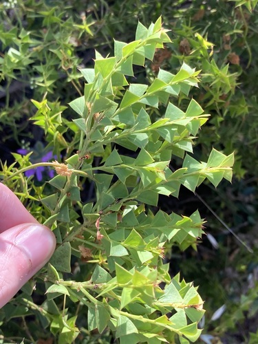
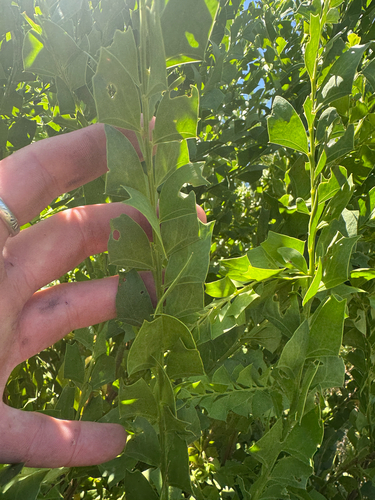
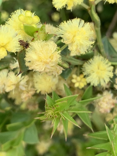
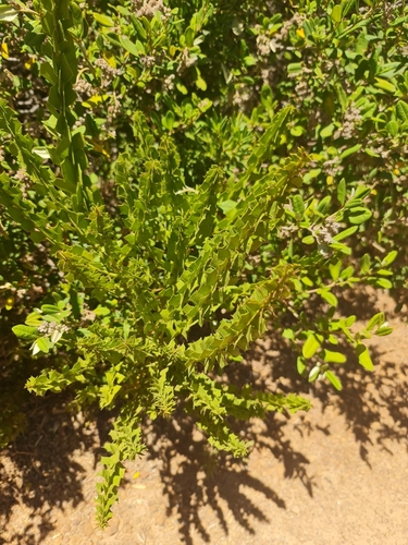
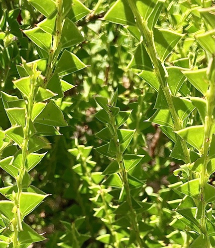
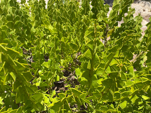
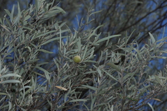
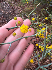
The photograph at the top: (c) Em Lamond, some rights reserved (CC BY), observed growing wild, observed 2020-07-31. Photographs: (c) Thomas Mesaglio, some rights reserved (CC BY); (c) Tyler Anthony, some rights reserved (CC BY); (c) Guy Taseski, some rights reserved (CC BY); (c) Belinda Forbes, some rights reserved (CC BY); (c) pimelea, some rights reserved (CC BY); (c) Caleb Catto, some rights reserved (CC BY). Credits as read from iNaturalist on 2026-11-04. What each licence allows.
Related
Similar habitat climate The 6 nearest by mean daily high, mean nightly low and rain, month by month. How.
 Hibbertia grossulariifolia Dilleniaceae Photo: CC BY, Leon Perrie
 Boronia alata Winged boronia Photo: CC BY, Caleb Catto
 Scaevola nitida Shining fanflower Photo: CC BY-SA, Tony Rebelo
 Eutaxia myrtifolia Egg and Bacon Plant Photo: CC BY, Belinda Forbes
 Chorizema ilicifolium Holly flame-pea Photo: CC BY, Em Lamond
 Chorilaena quercifolia Wild hop Photo: CC0, Philip Precey
Other Acacia 180 in the reference
 Acacia acinacea Gold-dust acacia Photo: CC BY, Kym Nicolson
 Acacia acuminata Jam wattle Photo: CC BY, Chantel McWilliam
 Acacia adunca Wallangarra wattle Photo: CC BY-SA, Greg Tasney
 Acacia alata Winged wattle Photo: CC BY-SA, Charles Stirton
 Acacia alpina Alpine Wattle Photo: CC BY, ttsquid
 Acacia amblygona Fan Wattle Photo: CC BY-SA, Greg Tasney
 Acacia ammobia Mount Conner Wattle Photo: CC BY, Murray Fagg
 Acacia amoena Boomerang wattle Photo: CC BY, prossington
 Acacia anceps Fabaceae Photo: CC0, Connor Margetts
 Acacia aneura Mulga Photo: CC BY-SA, Greg Tasney
 Acacia aphylla Leafless Rock Wattle Photo: CC BY, Tyler Anthony
 Acacia araneosa Balcanoona Wattle Photo: CC0, garrytre all 181 ›
Names & registers
Also known as Acacia decipiens var. major; Acacia decipiens var. multiflora; Acacia decipiens var. praemorsa; Acacia decipiens var. trapezoidea; Acacia decipiens var. triangularis and 5 more. (GBIF Backbone)
WFO Plant List (2026-06) accepted; matched by the exact name and authors: WFO files it under IPNI id 471669-1, Kew under none. World Flora Online, CC0; read 2026-11-13.
Published in Hort. Brit.: 406 (1830) (WCVP, RBG Kew, file of 2026-06-04)
Elsewhere IPNI (identifiers from Wikidata's item Q109894946, read 2026-11-13, CC0)
Chromosomes not decided: the page has no IPNI id, by which the records are read. ChromoDB, IAPT/IOPB chromosome data (Simon, Bosch & Blanché), version 3.1 of 8 November 2026, CC BY 4.0; read 2026-11-13.
The record
Predicted extinction risk not decided: the page has no IPNI id, by which the file is read. Bachman et al. 2024, New Phytologist; Kew's data of 1 February 2024, CC BY 4.0; read 2026-11-13.
CITES Not in the CITES Appendices (the edition in force from 5 March 2026): no listing of its name, its genus or its family. CITES Appendices I, II and III, valid from 5 March 2026; read 2026-11-13. The Appendices
Every figure here is derived from public data by a stated rule and names its source; nothing about this species is written for its page by a person or by AI, apart from the marked, credited quotations. How →
Where this page came from built 2026-11-18
gbif.species answeredGBIF's key 12194847 is Acacia trapezoidea (DC.) Jacques; the page links Kew's Acacia trapezoidea (DC.) G.Don, and the name is cited as Kew cites it (kept from this page's build of 2026-10-21)gbif.synonyms answeredkept from this page's build of 2026-11-01gbif.vernacular answeredasked 2026-11-18names fetched 2026-10-21; carried by an offline re-derivation of 2026-11-18wcvp.distribution answeredas of 2026-06-04gbif.occurrences answeredas of 2026-10-21GBIF occurrence download https://doi.org/10.15468/dl.hbdw64, of 2026-10-21; records tested against the native regions' shapes, openly licensed and restricted alike (Natural Earth's provinces, placed in TDWG's regions; shapes rule r87); a record within the margin, off a coast or on an island too small to draw counted only when it states the region's country, and only on no other region's land but within 0.02° of a native shape across a border, where its stated state or province does not name the other region (read by Natural Earth's name, its ISO 3166-2 code or an old province's name); 16 records within 1 km of a botanic garden, herbarium or zoo left out (13 at a botanic garden or arboretum, 3 at a zoo; Wikidata's list)climate answeredasked 2026-11-18climate.extremes answeredasked 2026-11-18NASA POWER (MERRA-2) daily 1981–2024, cell -34.00_115.000, lapse-corrected +41 m at 6.5 °C/kmwikidata answeredIPNI and POWO linked by Kew's number for Acacia trapezoidea (DC.) G.Don (the item's: IPNI 471669-1, POWO none) (kept from this page's build of 2026-10-21)wikipedia answeredkept from this page's build of 2026-10-21; not asked againinat.taxon answeredkept from this page's build of 2026-10-21inat.photos.wild answeredasked 2026-10-27from iNaturalist's API: research-grade observations not marked captive with an open-licence photograph, the observations iNaturalist puts first by votes, 24 of them (the open data of 2026-09-27 holds 96, and no votes); filled 2026-10-27; kept by the build of 2026-11-18 (this build: not asked: this build left iNaturalist to the daily fill, which asks for the photographs once the page's taxon is known)inat.photos.cultivated nothing to reportobservations marked captive or cultivated whose identifications agree; filled 2026-10-27 (kept from this page's build of 2026-10-21)gbif.media answeredas of 2026-10-21from the GBIF download https://doi.org/10.15468/dl.hbdw64, of 2026-10-21commons not askedkept from this page's build of 2026-10-29openalex not askedthe reference does not ask OpenAlex for papersEvery source is recorded as having answered, reported nothing, refused, failed, not been asked, or answered twice where one answer is taken (“not taken: two items answered”), and, for a source asked when this page was built, when: the figures are as the source held them that day; a source read from a file (Kew's World Checklist, a GBIF download) says "as of" the file's day instead; a row carried from an earlier build of the page names that build instead. Only “nothing to report” is ever shown as an absence. Records came from 21 datasets via GBIF.org; each carries its own licence.